336 Route 73, start to finish.
A 5,900 SF bank with drive-thru on 1.32 acres in Voorhees Township. Scroll to follow the project from the ground as it is today, through approvals and construction, to opening day.
The site today.
A wooded parcel fronting NJ Route 73, modeled from public LiDAR elevation data and the county parcel record. Every point you just saw is a measured ground elevation.
- Parcel
- 1.32 ac
- Zoning
- MB · Major Business
- Frontage
- NJ Route 73
- Today
- Vacant, wooded
What the rules allow.
The solid line is the property line. The dashed line is the zoning setback. What's left between them — the buildable envelope — is where a building is allowed to go.
- Gross site
- 1.32 ac
- Buildable envelope
- 0.88 ac
The proposed building sits entirely inside the envelope.
One building, one curb cut.
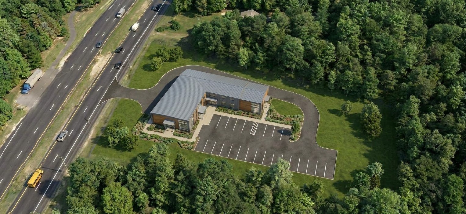
A one-story bank with a drive-thru, reached by a loop drive from a single Route 73 entrance, with parking alongside and landscaping along the edges.
- Building
- 5,900 SF
- Height
- 1 story
- Parking
- 25 spaces
- Access
- 1 curb cut
Review before anything moves.
Nothing is built until the project clears local and state review. Typical approvals for a project like this:
Sequence is illustrative; actual durations depend on agency schedules and review comments.
Clear and protect.
Trees inside the work area come down. Silt fence goes up around the disturbance to keep soil on site, and a stone construction entrance keeps mud off Route 73.
- Silt fence around the limit of disturbance
- Stone construction entrance at the curb cut
- Woods beyond the property line stay
Grade and connect.
The site is graded to its design elevations, and utility services are brought in from Route 73 before anything goes on top of them.
- Water service
- Sanitary sewer
- Storm drainage
- Electric
Utility routing shown is illustrative.
Build and pave.
The building goes up — structure first, then walls and roof. The parking lot and loop drive are paved, replacing the construction entrance.
Finish the ground.
Sidewalks, striping, lawn, and landscape trees go in. Once the ground is stabilized, the silt fence comes down.
Opening day.
Customers turn in at the single Route 73 entrance, park or follow the loop drive, and exit the same way. Through traffic on Route 73 keeps moving past the site.
What it looks like from Route 73.
This is eye level — about 5½ feet — from across Route 73. Hold Compare to today to see the same view as the site looks now.
As it will look.
The completed bank, drive-thru, parking, and landscaping, rendered from the same plan you just watched get built — seen from above Route 73.
Rendering is illustrative; final materials and landscaping are set by the approved plans.
336 Route 73 at a glance.
- Site
- 1.32 ac · MB zone
- Use
- Bank + drive-thru
- Building
- 5,900 SF, 1 story
- Parking
- 25 spaces
- Access
- 1 curb cut, Route 73
- Approvals
- ≈ 9–14 months
This walkthrough is a communication tool for project review, built from public LiDAR, the county parcel record, and the preliminary development plan. It is illustrative and not for construction — the signed and sealed plan set governs.